

















































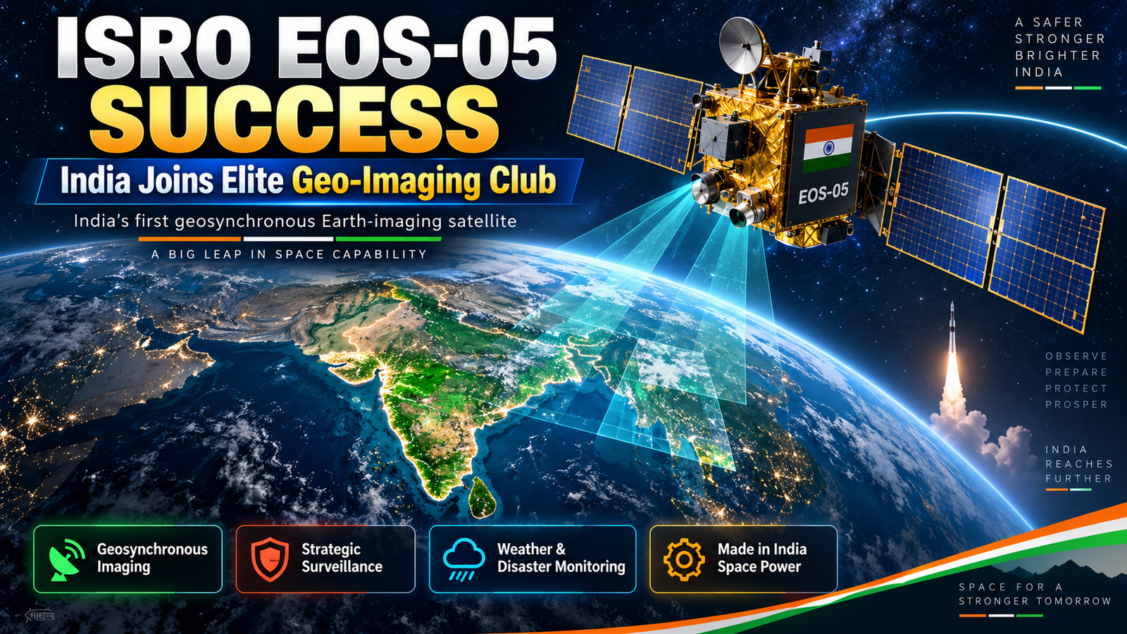

ISRO’s EOS-05 Success: India Joins Elite Geo-Imaging Satellite Club
India has taken a major leap in space-based Earth observation.
The Indian Space Research Organisation successfully launched EOS-05—India’s first dedicated imaging satellite designed to operate from a geosynchronous orbit—aboard the GSLV-F17 rocket on September 4, 2026.
The 2,367-kilogram satellite was launched at 2:55 a.m. IST from the Satish Dhawan Space Centre in Sriharikota. Approximately 18 minutes later, the rocket successfully placed EOS-05 into its intended sub-geosynchronous transfer orbit.
The mission gives India the ability to monitor the subcontinent repeatedly from almost 36,000 kilometres above Earth. It could support disaster response, agriculture, environmental monitoring, infrastructure planning and strategic surveillance.
But has India really joined a “hyper-elite club” previously occupied only by China?
The answer is impressive—but slightly more complicated than some headlines suggest.
What Exactly Did ISRO Accomplish?
ISRO’s official mission page describes EOS-05 as a state-of-the-art Earth-observation spacecraft and India’s first imaging satellite intended for geosynchronous orbit.
Most Indian Earth-observation satellites operate in low Earth or sun-synchronous orbits, usually a few hundred kilometres above the planet. These satellites can capture highly detailed images, but they move continuously around Earth.
They can observe a location only when their orbital path brings them over that area.
EOS-05 uses a different approach. From geosynchronous altitude, it can keep the same broad region within view for extended periods. This allows India to observe developing events repeatedly without waiting for another satellite pass.
That difference makes EOS-05 particularly valuable during fast-moving emergencies.
Geosynchronous and Geostationary: What Is the Difference?
The two terms are often used interchangeably, but they are not identical.
A geosynchronous satellite takes approximately 24 hours to orbit Earth, matching the planet’s rotational period.
A geostationary satellite is a special type of geosynchronous satellite operating in a circular orbit directly above the equator. From the ground, it appears to remain fixed over one location.
ISRO has officially described EOS-05 as a geosynchronous imaging satellite. Its precise operational behaviour will depend on the final orbit established after commissioning.
The safest description at this stage is India’s first dedicated Earth-imaging spacecraft for geosynchronous orbit.
What Can EOS-05 See?
EOS-05, also known as GISAT-1A, is designed to capture multispectral and hyperspectral information.
A normal colour camera records only a few broad colour bands. A hyperspectral sensor divides reflected light into many narrower bands. This can help analysts identify differences in crops, vegetation, soil, water, minerals and environmental conditions that may not be visible in an ordinary photograph.
The publicly described GISAT mission profile includes the ability to monitor selected areas at short intervals and produce wider images of the Indian landmass much more frequently than conventional low-orbit satellites.
Potential applications include:
- Cyclone and flood monitoring
- Wildfire and smoke detection
- Landslide assessment
- Crop-health observation
- Drought and water-resource monitoring
- Forest and environmental management
- Urban expansion and infrastructure planning
- Coastal and maritime awareness
- Monitoring of strategically important regions
Because it is an optical imaging spacecraft, cloud cover may limit some observations. India will continue relying on radar satellites such as the RISAT series and NISAR for imaging through clouds and during darkness.
EOS-05 is therefore an important new layer in India’s observation network—not a replacement for every other satellite.
Is India Really Second Only to China?
China is the clearest publicly confirmed comparison.
China launched Gaofen-4 in December 2015. The China National Space Administration described it as a high-orbit remote-sensing satellite capable of continuously observing natural disasters because it moves synchronously with Earth.
China later expanded its high-altitude Earth-observation capabilities through additional Gaofen satellites.
EOS-05 places India among a very small number of countries operating dedicated high-resolution land-imaging spacecraft from geosynchronous or geostationary altitude.
However, saying that only China has ever operated “this type of satellite” requires qualification.
The United States, Japan, South Korea and European countries operate geostationary weather, environmental or ocean-observation satellites with imaging instruments. Some military capabilities are also not publicly disclosed.
What makes EOS-05 unusual is its combination of:
- Geosynchronous operation
- Frequent regional observation
- Multispectral and hyperspectral imaging
- Civilian, developmental and strategic applications
- A mission focused heavily on the Indian subcontinent
India has therefore entered a rare and highly advanced category of dedicated geo-imaging capability, even if it is not literally the second country to capture any Earth image from geostationary altitude.
Why EOS-05 Is Important for Disaster Management
Low-orbit satellites may capture excellent images of a flood or cyclone, but their availability depends on when they pass over the affected region.
EOS-05 can keep a much larger area under repeated observation.
During a cyclone, for example, authorities could use frequent images to assess:
- Rapidly changing cloud and surface conditions
- Coastal flooding
- Damage to roads and bridges
- Areas becoming isolated
- Movement of smoke or fire
- Locations requiring urgent assistance
Faster information can help the National Disaster Management Authority, state governments and emergency services deploy rescue teams more effectively.
This capability is especially important for India, where floods, cyclones, landslides, heatwaves and forest fires affect millions of people.
How Will Farmers Benefit?
Agriculture depends heavily on soil conditions, rainfall, irrigation and crop health.
EOS-05’s spectral imaging could help identify large-scale changes involving:
- Crop stress
- Drought conditions
- Vegetation health
- Irrigation coverage
- Pest or disease patterns
- Flood damage to farmland
- Changes in reservoirs and water bodies
Satellite information cannot replace inspections on the ground. However, it can help authorities determine where field teams should be sent and where assistance may be required most urgently.
The Strategic Importance of EOS-05
Earth-observation technology is inherently dual-use. The same satellite supporting disaster management and agriculture can also improve strategic awareness.
Frequent regional imagery could help India monitor:
- Border infrastructure
- Large military movements
- Ports and airfields
- Maritime activity
- Construction in remote areas
- Changes around critical installations
Public information does not reveal the satellite’s complete strategic capabilities, revisit performance or tasking arrangements.
EOS-05 should therefore not be portrayed as a weapon or an all-seeing surveillance system. Its value comes from providing broader and more frequent imagery that can be combined with higher-resolution low-orbit satellites, radar systems, aircraft and ground intelligence.
A Major Comeback After EOS-03
India attempted to launch an earlier geo-imaging satellite, EOS-03 or GISAT-1, in August 2021.
That mission failed after the GSLV’s cryogenic upper stage did not perform successfully. ISRO’s spacecraft record lists EOS-03 as an unsuccessful launch.
EOS-05 represents a successful return to the same important objective.
The GSLV Mark II uses an indigenously developed cryogenic upper stage. Mastering cryogenic engines is difficult because they operate with fuels stored at extremely low temperatures and require precise control under demanding flight conditions.
The successful GSLV-F17 mission therefore demonstrates progress in both satellite technology and India’s ability to launch heavy spacecraft towards high-altitude orbits.
Why This Mission Matters for Atmanirbhar Bharat
EOS-05 reduces India’s dependence on foreign satellite imagery for time-sensitive national requirements.
An indigenous system gives India greater control over:
- Which regions are observed
- How frequently images are captured
- Who receives sensitive data
- How quickly information reaches authorities
- Future upgrades and replacement satellites
It also strengthens India’s domestic ecosystem of scientists, engineers, component suppliers and space-technology companies.
What Happens Next?
The mission will become fully successful only after EOS-05 reaches its final orbit and completes testing.
ISRO must confirm:
- Successful orbit-raising manoeuvres
- Deployment of spacecraft systems
- Stable power and communication
- Payload activation
- Sensor calibration
- Quality of the first images
- Start of operational services
Until then, claims about exact image quality and strategic performance should remain cautious.
Conclusion
The successful GSLV-F17 launch of EOS-05 is a historic achievement for India.
It gives the country its first dedicated Earth-imaging satellite designed for geosynchronous orbit and strengthens India’s ability to observe large areas repeatedly from approximately 36,000 kilometres above Earth.
China remains the clearest international comparison for dedicated high-resolution geo-imaging. Other countries operate geostationary weather and environmental satellites, making the broader “only China” claim inaccurate without qualification.
Even with that correction, the significance of EOS-05 is enormous.
India now possesses a rare combination of indigenous launch capability, high-altitude spacecraft engineering and near-real-time regional Earth observation. Once fully commissioned, EOS-05 could become one of the country’s most valuable satellites for disaster response, agriculture, environmental protection and national security.
Frequently Asked Questions
When was EOS-05 launched?
ISRO launched EOS-05 aboard GSLV-F17 at 2:55 a.m. IST on September 4, 2026.
Has EOS-05 reached its final orbit?
Not yet. GSLV-F17 placed it into a sub-geosynchronous transfer orbit. The satellite must complete orbit-raising and commissioning operations.
What is EOS-05 used for?
It is designed for frequent Earth observation supporting disaster management, agriculture, environmental monitoring, infrastructure planning and strategic awareness.
Is EOS-05 also called GISAT-1A?
Yes. EOS-05 is widely identified as GISAT-1A, the successor to the EOS-03/GISAT-1 mission lost in 2021.
Is India the only country apart from China with this technology?
India has joined a very small group operating dedicated high-altitude geo-imaging spacecraft. China is the closest publicly confirmed comparison, although several other countries operate geostationary weather and environmental imaging satellites.
Can EOS-05 see through clouds?
Optical and hyperspectral imaging can be affected by clouds. Radar satellites remain more suitable for reliable imaging through cloud cover and during darkness.
Editorial Disclaimer
This article is based on official ISRO information and publicly available reporting as of September 4, 2026. GSLV-F17 successfully placed EOS-05 into its intended transfer orbit, but final orbit-raising and spacecraft commissioning were still required at the time of publication. Some payload specifications and strategic applications may be restricted or subject to change. References to an “elite club” describe the rarity of dedicated geosynchronous Earth-imaging systems and should not be interpreted as meaning that only India and China operate any satellite capable of imaging Earth from high orbit.
